Utility Mapping Survey in Woolton
Utility Mapping Surveys with PAS128 Accuracy, Helping You Build Safely with Confidence
Get a Free Quote From Us Today!
We aim to get back to you in 24 hours.
At Utility Mapping Survey, we deliver precision detection and mapping of underground infrastructure in Woolton L25 7 and across the UK. Our service focuses on identifying buried services such as gas, electricity, and water pipes to prevent accidental strikes and support safe project planning.
By providing highly accurate data, utility mapping surveys help engineering and construction teams maintain site safety while meeting their statutory obligations.
How Much Does a Utility Mapping Survey Cost in Woolton?
The cost of a utility mapping survey in Woolton ranges from £650 to over £5,000, depending on the site area, the complexity of the subsurface environment, and the required PAS 128 survey level.
Costs are primarily influenced by the density of buried services, the type of ground surface, such as reinforced concrete or soft soil, the need for overnight site work to manage traffic, and the level of data processing required for CAD or BIM integration.
Contact Utility Mapping Survey to get customised prices for utility mapping at your property.
What Services Are Included in Utility Mapping Surveys in Woolton?
Comprehensive technical assessments are included in every utility mapping survey in Woolton to provide a robust overview of the site’s underground environment:
- Desktop Survey – Reviewing existing service records from providers to identify potential asset locations before arriving on site.
- EML Tracing – Using electromagnetic locators to trace metallic pipes and cables by detecting active signals or induction.
- GPR Scanning – Employing Ground Penetrating Radar to identify non-metallic objects such as plastic pipes, fibre optics, and voids.
- CCTV Drain Surveys – Inserting camera equipment into drainage networks to map the path and condition of sewer systems.
- Topographical Integration – Layering utility data onto a surface survey to provide a complete 3D model of the project area.
Request Your Utility Survey Quote
Where Are Utility Mapping Surveys Required Across Projects in Woolton?
Statutory and safety-critical utility mapping survey in Woolton is required on any site where intrusive groundworks or heavy construction is planned to occur.
We frequently deploy our teams to highways and major road developments to prevent disruption to national infrastructure, as well as to brownfield regeneration sites where old utilities may be undocumented. In commercial and residential developments, these surveys are vital for verifying the feasibility of new connections.
When Should You Carry Out a Utility Mapping Survey in Woolton?
You should arrange for a utility mapping survey in Woolton during the feasibility or pre-design phase of a project to ensure that buried risks are accounted for before any excavation begins. Early intervention supports the selection of safe dig areas, which prevents damage to high-pressure mains and high-voltage cables.
It is also essential to carry out a survey following any significant site alterations to update the master site records. Proactive surveying ensures that project risks are mitigated and helps site managers demonstrate due diligence under the HSG47 health and safety guidelines.
How Does the Utility Mapping Survey Process Work in Woolton?
The structured methodology used for a utility mapping survey in Woolton begins with a thorough site reconnaissance to identify access points such as manholes and valve boxes. We then proceed with a dual-technology approach, combining EML and GPR to ensure that both metallic and non-metallic services are detected.
Every identified utility is surveyed using a Total Station or GPS, allowing us to plot the data onto a coordinate system. This rigorous data capture leads to the production of detailed CAD drawings, which serve as the definitive guide for all following on-site groundworks.
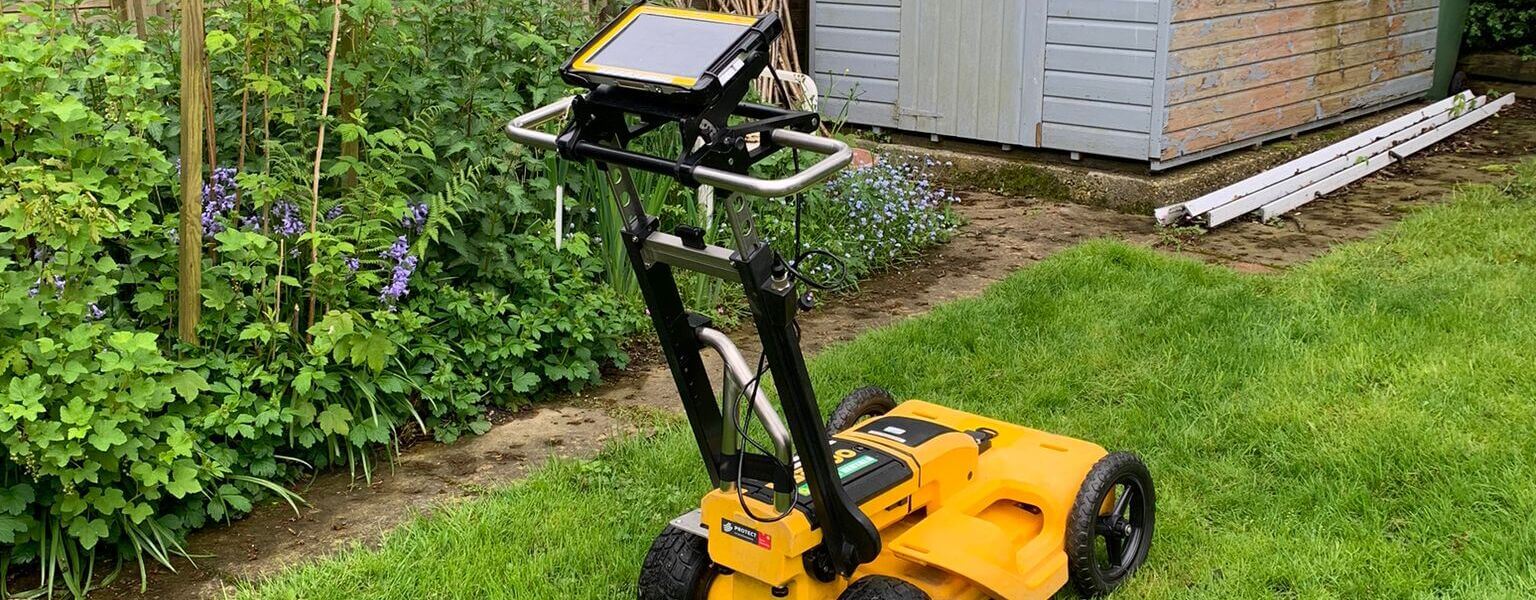
What Technologies Are Used in Utility Mapping Surveys in Woolton?
Our specialists at utility mapping survey in Woolton employ a diverse range of advanced geophysical technologies to deliver accurate subsurface data:
- Ground Penetrating Radar – Utilising electromagnetic pulses to detect buried plastic, clay, and concrete pipes that EML cannot find.
- Electromagnetic Locators – High-precision tools used to trace conductive services like power cables and metallic water mains.
- Robotic Total Stations – Capturing sub-centimetre accurate coordinates for every detected utility to ensure precise mapping.
- Sonde Systems – Small transmitters inserted into non-metallic pipes or drains to allow for external tracing of the network's path.
- High-Accuracy GPS – Providing absolute global positioning data to align utility maps with national grid coordinates.
Which Industries and Projects Require Utility Mapping Surveys in Woolton?
A wide variety of sectors rely on a utility mapping survey in Woolton to fulfil their safety obligations and project requirements:
- Civil Engineering Firms – Requiring precise data for the design and construction of bridges, tunnels, and complex infrastructure.
- Local Authorities – Seeking accurate maps for the maintenance and repair of public highways and street lighting networks.
- Property Developers – Utilising subsurface data to manage the installation of new service connections and drainage systems.
- Renewable Energy Contractors – Mapping routes for wind farm cabling or solar array infrastructure to avoid existing service clashes.
- Utility Providers – Verifying the exact position of their own assets before performing upgrades or emergency repairs.
Speak to a Utility Mapping Expert
How Quickly Can a Utility Mapping Survey Be Completed in Woolton?
The duration for a utility mapping survey in Woolton can range from a single day for small urban sites to several weeks for large-scale infrastructure projects. We prioritise efficient data processing workflows, ensuring that digital drawings are delivered shortly after the site work is finished.
For urgent excavations, we can provide on-site marking or sketching to define safe digging zones immediately. This rapid turnaround ensures that site downtime is minimised, allowing your construction teams to maintain their schedules while operating under a high standard of safety.
What Safety Standards and Regulations Apply to Utility Mapping Surveys in Woolton?
Uncompromising adherence to the PAS 128:2022 specification is how a utility mapping survey in Woolton ensures technical consistency and legal compliance. This standard dictates the level of detection and accuracy required, ranging from a simple record check to intrusive verification.
Our surveyors also follow the HSG47 guidelines for avoiding danger from underground services, which is the primary health and safety benchmark in the UK. By following these rigorous codes, we provide a verified and defensible data set that protects both the client and the contractor from prosecution following utility damage.
Why Should You Choose Professional Utility Mapping Survey Services in Woolton?
Technical accuracy and a reduction in operational risk are the primary reasons why a utility mapping survey in Woolton should be conducted by accredited specialists. An independent survey provides unbiased verification of site conditions, uncovering buried hazards that statutory records frequently omit or misplace.
This professional oversight reduces the likelihood of service strikes, which are not only dangerous but can result in massive financial penalties and site shutdowns. Investing in an expert survey optimises the design process, providing the technical assurance needed to build confidently and safely.
Contact Utility Mapping Survey for a consultation to get utility mapping tailored to your organisation’s risks and responsibilities.
Book Your Utility Survey Now
What People are Saying About Us
★★★★★
“Excellent service from start to finish. The utility mapping survey was completed quickly and the results were clear and easy to understand.”
James Turner
North West
★★★★★
“Very professional team. They identified underground services accurately, which helped plan our excavation work safely. The whole process was well organised.”
David Wilson
North West
★★★★★
“The survey report was detailed and delivered on time. It gave us full confidence before starting site works and helped avoid any potential issues on site.”
Sarah Mitchell
North West
★★★★★
“Great communication throughout. The team explained the process clearly and provided reliable utility mapping data for our project.”
Mark Robinson
North West
Our Locations
Looking for our services in another area in Merseyside? We are proud to work nationally across the UK, allowing us to ensure we can provide our specialist Utility Mapping Survey services to you.
For a full list of locations we cover in Merseyside, see below.